K‑Link (Re imagining hydrological corridors)

- vidhi bhanushali
This project transforms Bengaluru’s rajakaluves into resilient hydrological corridors that function as community spaces, combining flood mitigation, ecological restoration, and vibrant public spaces. By strengthening the historic kere–rajakaluve network, it responds to the city’s challenges of recurring floods, degraded waterways, and disconnected urban growth. A multi scalar framework guides the interventions:
• Micro scale: improving nodes such as crossings, junctions, and inlets.
• Meso scale: designing 200–500 m segments with green buffers, public interfaces, and ecological edges.
• Macro scale: creating continuous blue–green corridors across the valley system.
Core strategies include restoring stream morphology, improving infiltration and groundwater recharge, strengthening edges with green buffers, and integrating cultural and recreational spaces. Together, these interventions unify hydrology, ecology, and public life. Beneficiaries include city residents and local communities, supported by BBMP, BWSSB, NGOs, neighborhood groups, and private developers who will help implement and sustain this civic infrastructure.
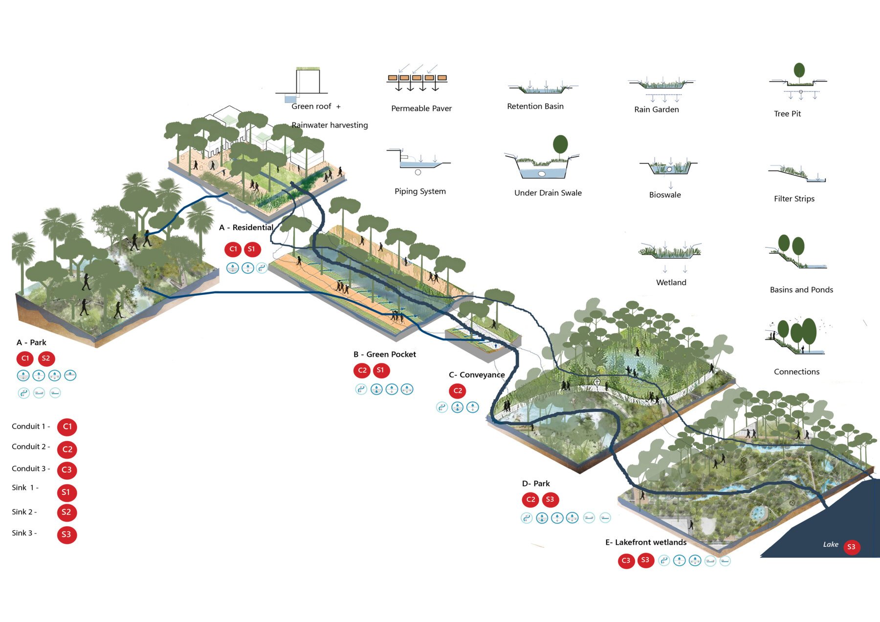
The project is structured around a sink–conduit framework that reads the city as a hydrological system of movement, storage, and absorption. It begins by tracing how monsoon runoff travels through roads, streams, open spaces, and built edges, identifying streets and rajakaluves as conduits, and parks, wetlands, setbacks, and low-lying grounds as sinks. Using a multi-scalar approach, interventions operate at the micro scale (junctions, crossings, and inlets where flow is redirected or slowed), meso scale (200–500 m segments where sinks and conduits are spatially coordinated), and macro scale (continuous valley-wide rajakaluve corridors). Design strategies prioritize slowing, filtering, storing, and infiltrating water through nature-based solutions such as bioswales, detention lawns, constructed wetlands, and riparian buffers. By reprogramming everyday urban spaces to perform hydrological roles, the project integrates flood management, ecological restoration, and public life into a connected blue–green system that responds to seasonal change and long-term resilience.
The project delivers a continuous blue–green network that transforms fragmented rajakaluves into multifunctional public landscapes. The output is a resilient hydrological system that mitigates flooding, improves groundwater recharge, enhances water quality, and restores ecological processes at a watershed scale. Parks function as seasonal flood lawns, streets operate as conveyance corridors, and wetlands act as retention and purification zones. The design integrates recreational spaces, cultural nodes, interpretive trails, and community interfaces, making water systems visible, accessible, and meaningful in daily urban life. Ecologically, the corridors support biodiversity through riparian buffers, native planting, and restored stream morphology. Socially, they create safer, inclusive public spaces that reconnect people with water. Institutionally, the project establishes a scalable framework that can be implemented and maintained through collaboration between municipal agencies, local communities, NGOs, and private stakeholders—positioning rajakaluves as long term civic infrastructure rather than residual drainage channels.
- vidhi bhanushali
Gallery
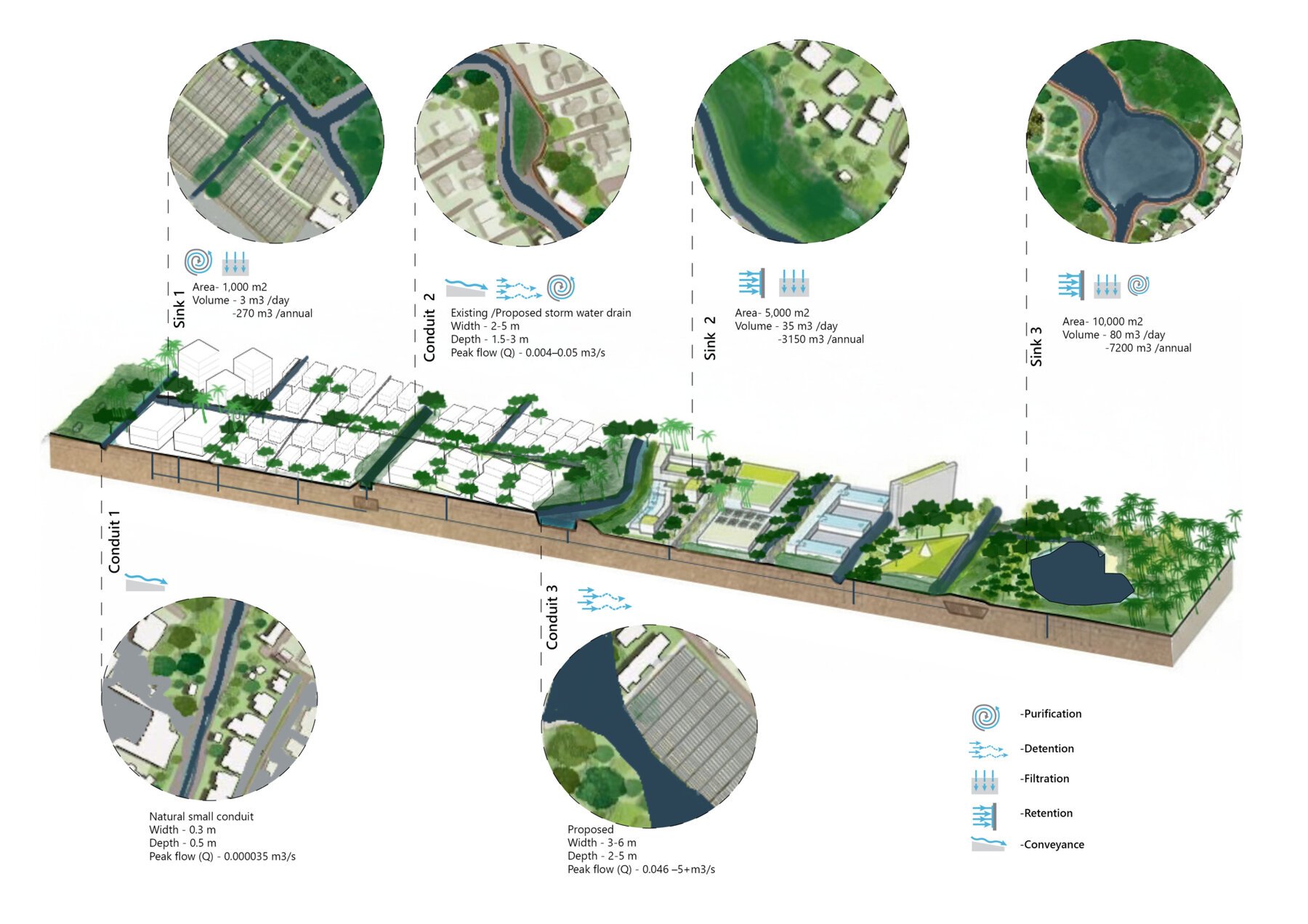
Diagram showing how water flows through a hierarchy of conduits and sinks, each designed to capture, convey, and store runoff at increasing capacities
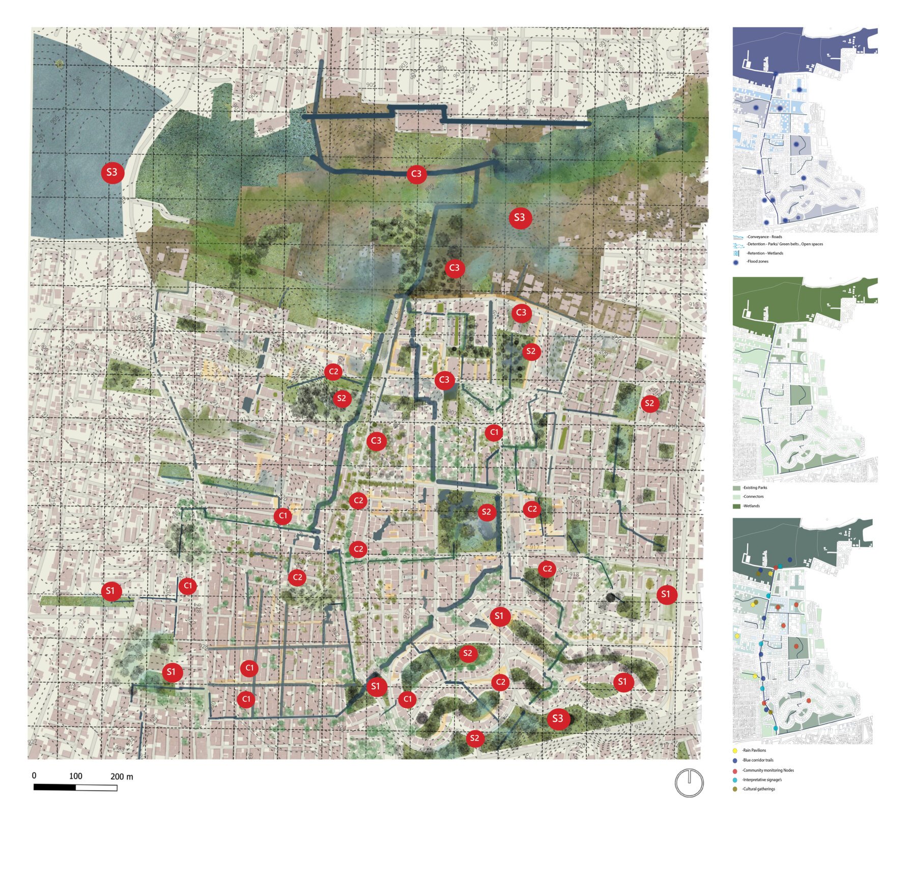
The master plan weaves together a hierarchy of conduits and sinks to guide, slow, store, and treat water across the neighborhood. Primary, secondary, and tertiary conduits trace existing streets and drainage lines, channeling seasonal runoff toward key sinks such as parks, wetlands, lake buffers, and residential pockets. Each sink is designed to hold, filter, and recharge water through nature-based interventions — rain gardens, bio-retention basins, permeable landscapes, and restored water edges.
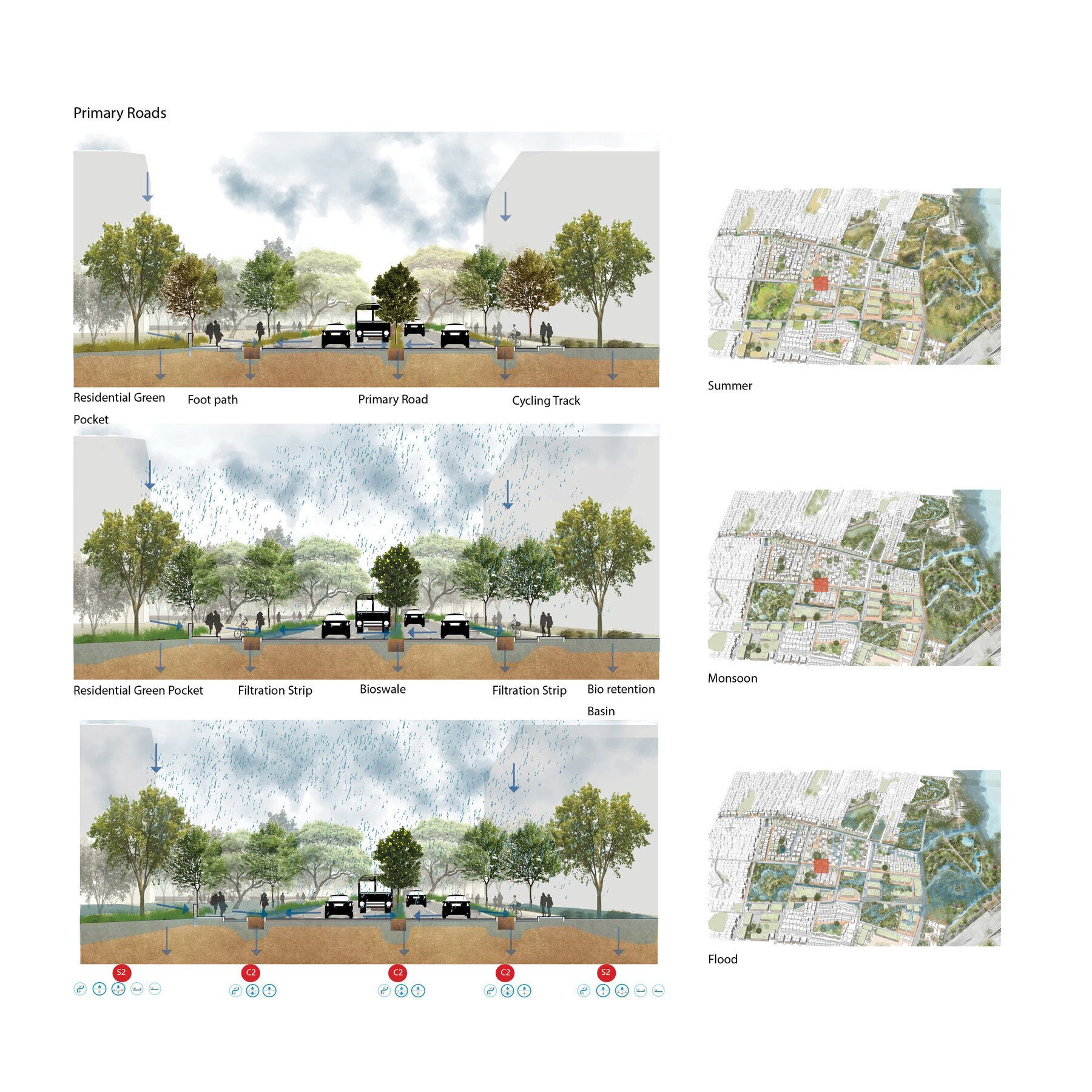
A water-sensitive primary road that filters, channels, and stores runoff as it transforms from dry-season mobility space to a monsoon and flood-responsive corridors.
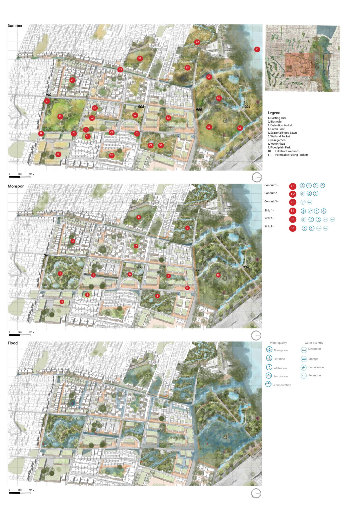
A layered mapping of summer, monsoon, and flood conditions showing how sinks and conduits activate across the site to absorb, slow, store, and convey water — transforming everyday open spaces into a resilient blue – green network that rejuvenates ecology while safeguarding urban life.
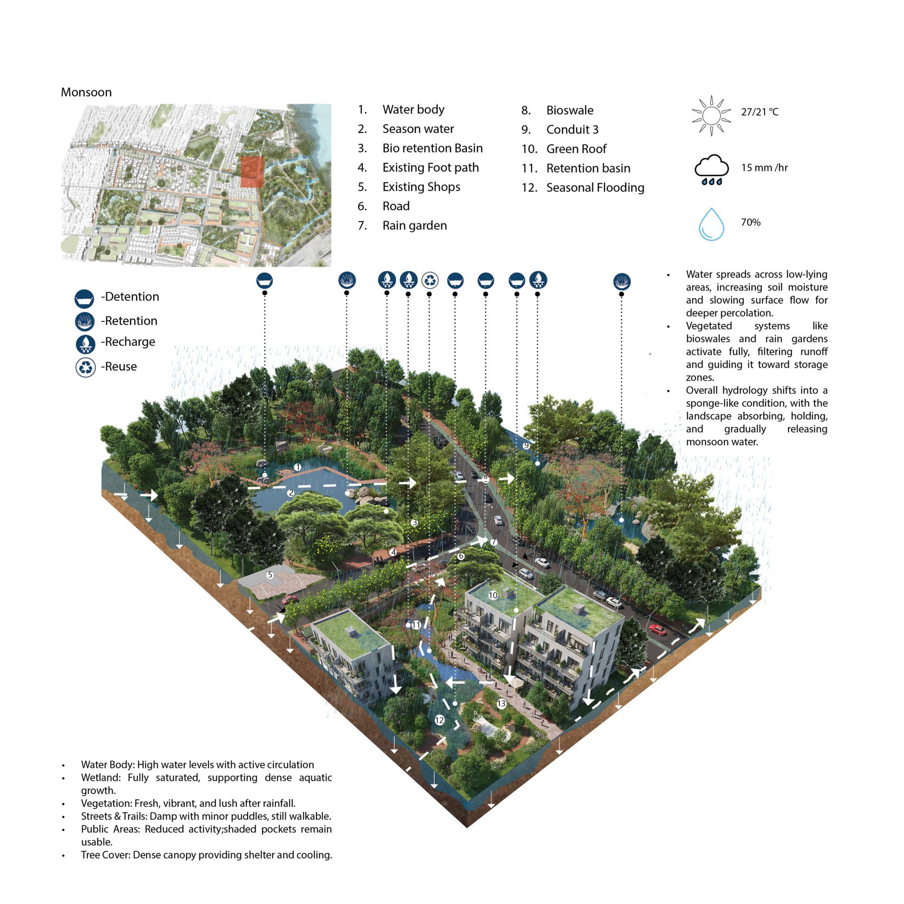
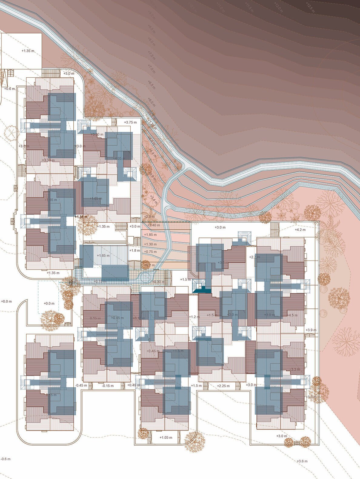
The sink – conduit landscape absorbs, filters, and stores monsoon runoff through bioswales, retention basins, wetlands, and green roofs, allowing water to spread across low-lying areas, recharge the ground, and release gradually — transforming the site into a sponge-like, flood-resilient public landscape.