- hala m patangiya
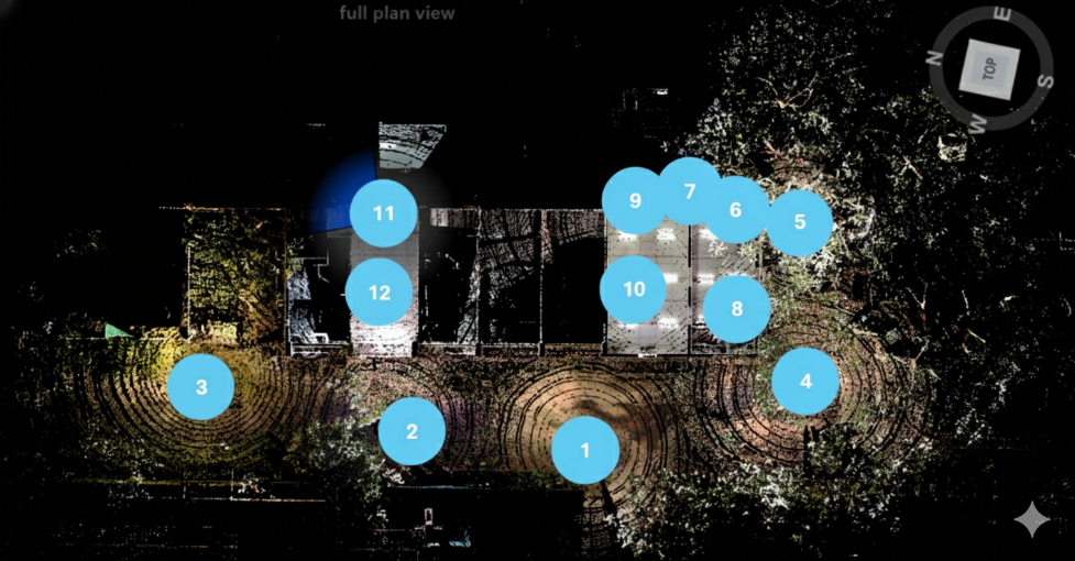
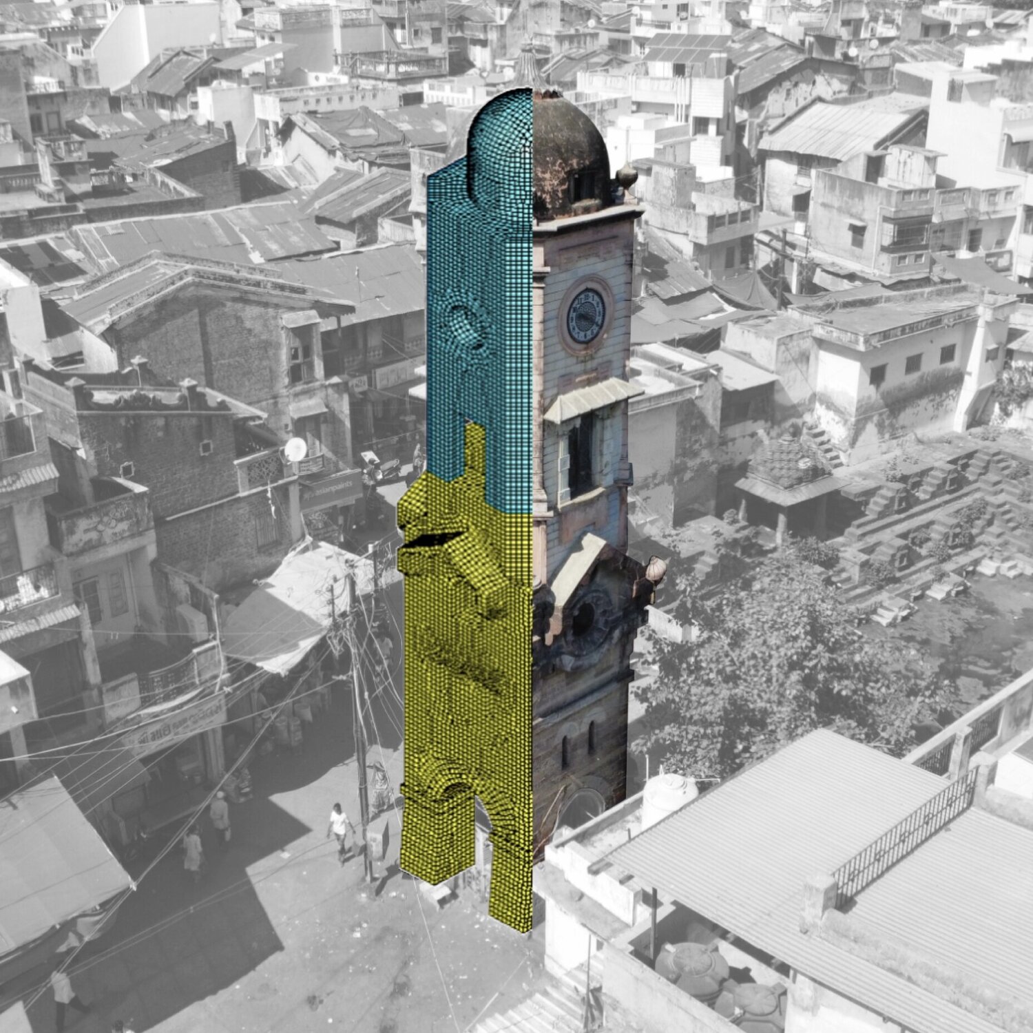
LiDAR scan locations
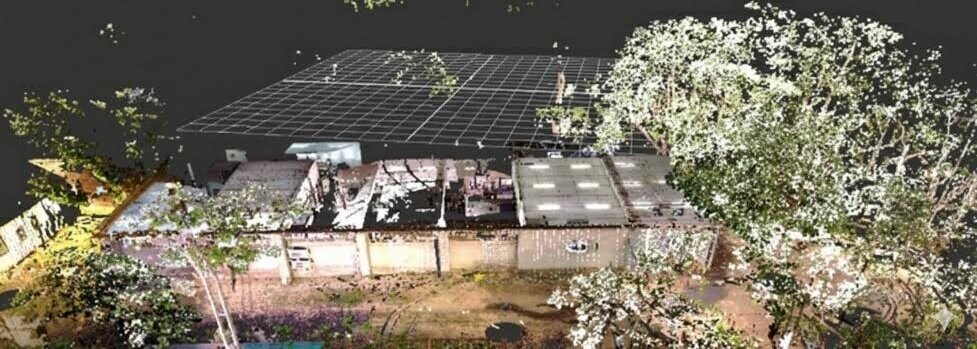
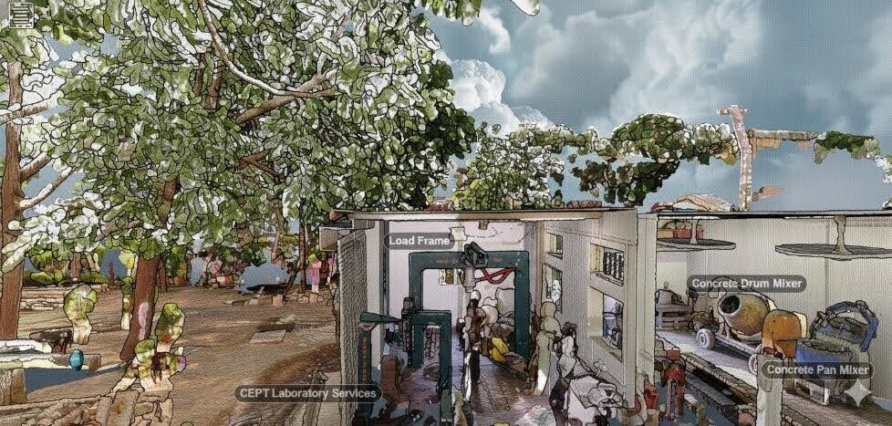
3D Model overview
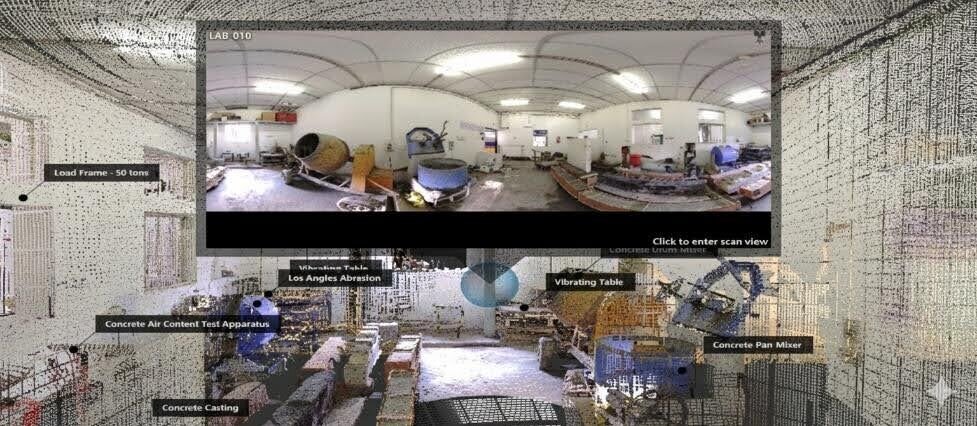
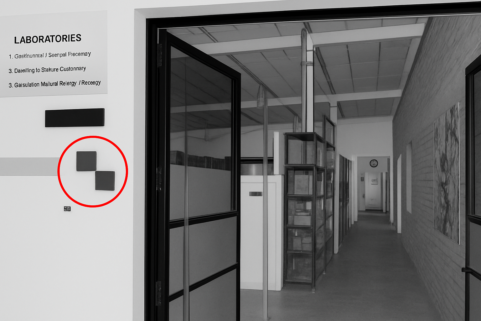
Concrete Technology Lab
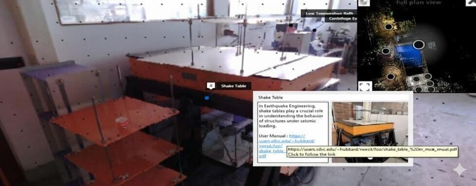
Annotation and detailing of equipment
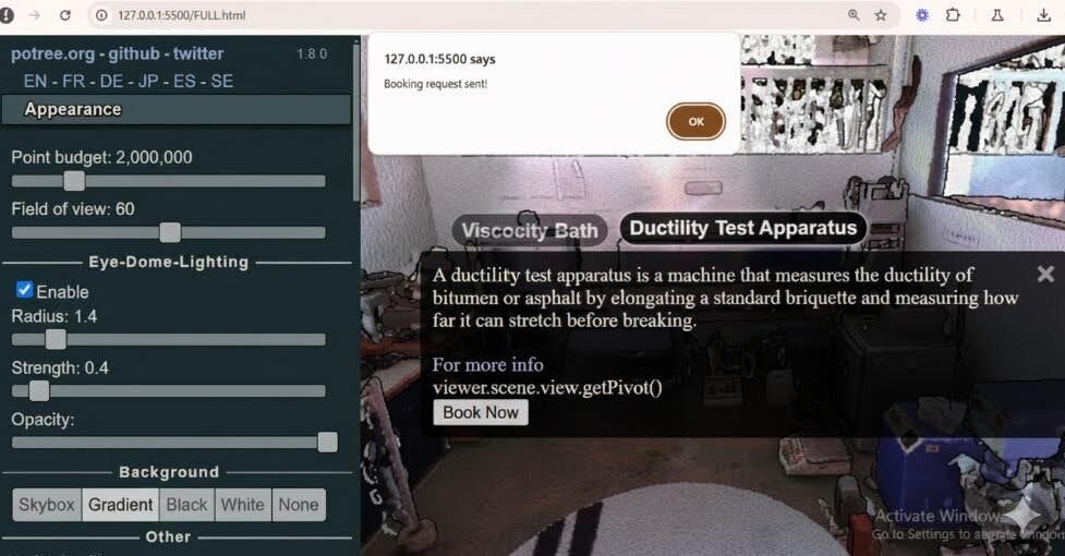
Equipment booking module
About the project
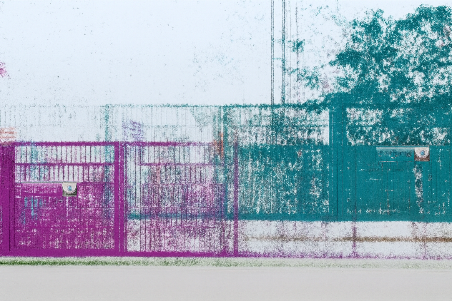
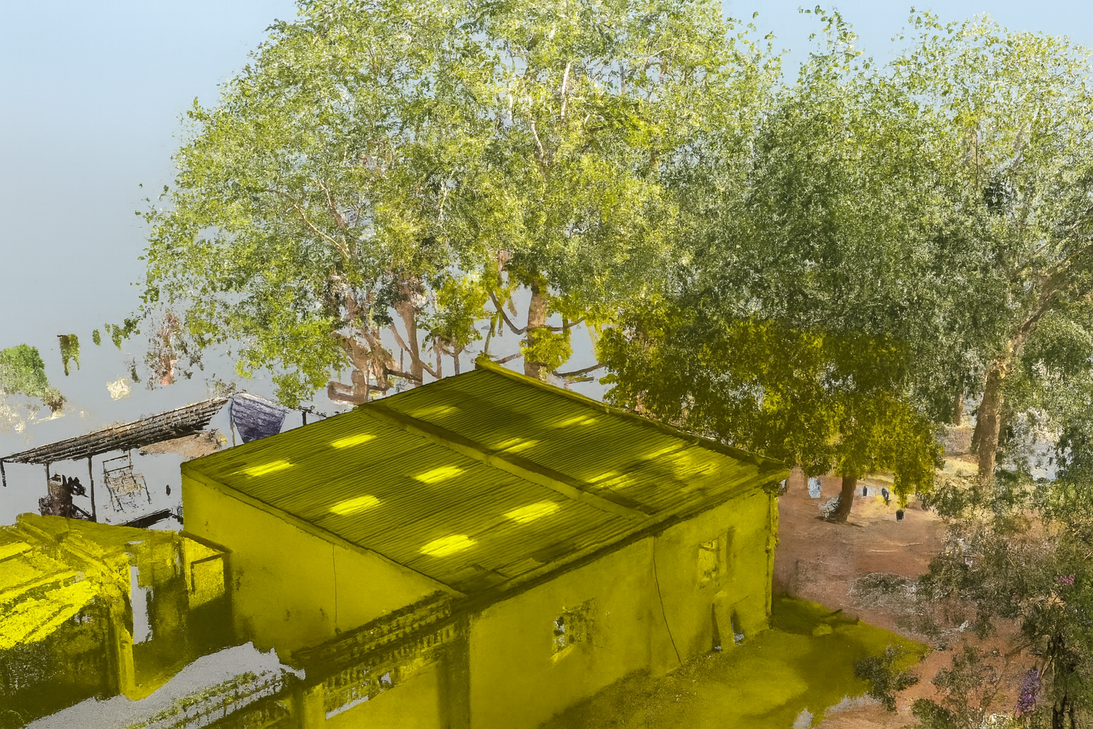
This project develops a system to improve how CEPT University laboratories are viewed, accessed, and used. Equipment is spread across multiple rooms, which makes it difficult for users to locate what they need at the right time, understand available space, or plan their work. Twelve LiDAR scans were collected using FARO Focus Laser Scanner across material lab, including the Concrete Technology, Geotechnical, and Highway Engineering laboratories. Point-cloud data and ground control points were used for further processing and alignment. Each scan captured equipment, storage areas, pathways, and structural components to ensure complete coverage of the lab arrangement. The final model presents the laboratory conditions in a simple and understandable format that users can rely on for locating equipment, understanding the space, planning tasks, and using a web-based platform to book equipment when required.
Approach
After data collection, the raw LiDAR scans were processed through alignment, target detection, coordinate assignment, and image linking. Noise filtering was applied to improve clarity, and the combined point-cloud data achieved an overall alignment accuracy of about 2.5 mm. The cleaned scans were then structured into a 3D model that could be viewed and navigated smoothly. Equipment photographs, names, and basic information were added as annotations so that users can identify instruments directly within the model. The model supports tools for measurement, spacing checks, boundary checks (Edge Highlighting), region-based viewing, reflectivity interpretation, elevation review, and navigation of the required equipment.
Potree Converter was then used to convert the point-cloud data into a web-ready 3D model, which supports the model’s equipment-booking feature that allows users to check availability and make reservations in advance.
Output
The final output is a detailed 3D Lab Information Model that shows equipment positions, dimensions, spacing, and usable floor areas inside CEPT laboratories. Users can measure distances, examine elevations, check boundaries, and understand changes in material through reflectivity values. These tools support day-to-day laboratory planning and equipment handling. Each piece of equipment includes annotations with photographs, specifications, and basic usage notes, making identification easy. The system also includes an equipment-booking feature, which lets users check availability and reserve instruments when required. This helps reduce delays, avoids overlap in usage, and improves coordination. It also provides a 360-degree virtual tour and AR view, allowing users to explore the space without being physically present. Overall, the system improves access to information, reduces confusion in busy lab settings, and supports smooth workflows by presenting clear and reliable data about equipment and space.
- hala m patangiya
Gallery
Raw LiDAR scan alignment
Calibration checkerboards used for precise spatial referencing
Point-cloud generation